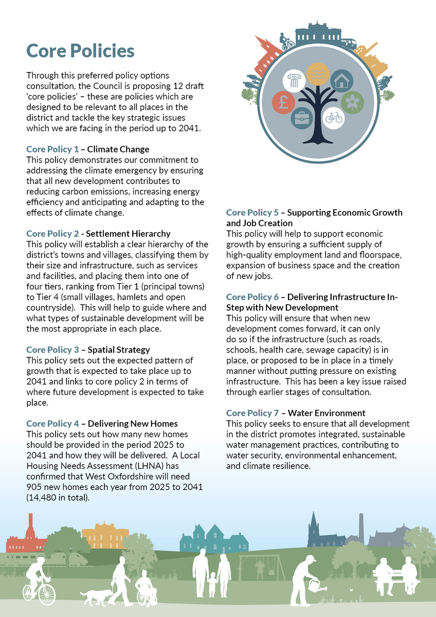
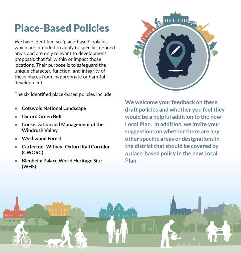
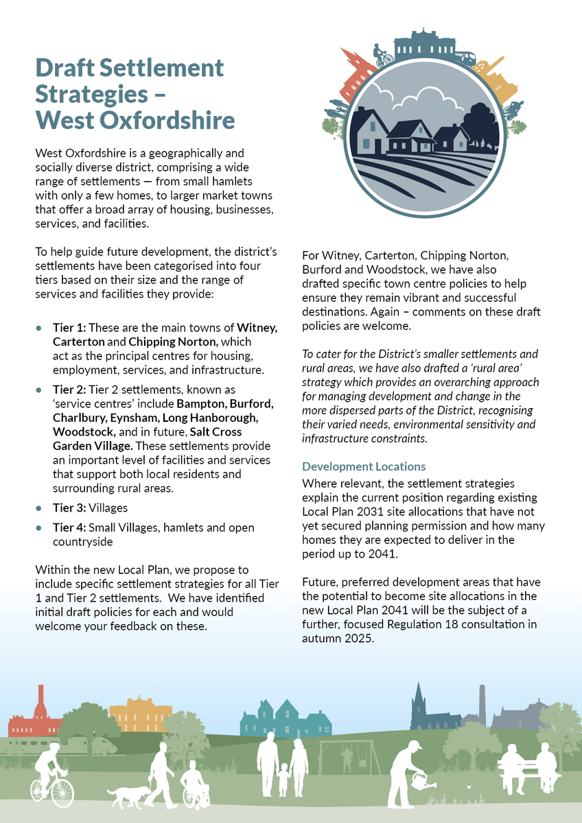
×

Warning message

The installed version of the browser you are using is outdated and no longer supported by Konveio. Please upgrade your browser to the latest release.

Local Plan Preferred Policy Options - June 2025

File name:

-

File size:

-

Title:

-

Author:

-

Subject:

-

Keywords:

-

Creation Date:

-

Modification Date:

-

Creator:

-

PDF Producer:

-

PDF Version:

-

Page Count:

-

Page Size:

-

Fast Web View:

-

Choose an option Alt text (alternative text) helps when people can’t see the image or when it doesn’t load.
Aim for 1-2 sentences that describe the subject, setting, or actions.
This is used for ornamental images, like borders or watermarks.
Preparing document for printing…
0%
Document is loading Loading Glossary…

Summary

All Hide

Welcome to the You Plan for the future - Preferred Policies consultation

Expand

Background Context

Challenges and Opportunities

Draft Vision and Objectives

Core Policies


Place Based Policies


Settlement Strategies


Development Management Policies


Powered by Konveio

Comments

View all Cancel

Commenting is closed for this document.


I would like to make a general comment
I am writing to convey my opinion as an established resident of Bampton, on the misplacement of Bampton as a Tier 2 Village classification. It does not enjoy any of the established infrastructure, or community facilities of other Tier 2 Villages or Towns listed in your current draft Local Plan. We have over capacity in our local Doctors Surgery and Primary School, limited employment, minimal shopping and car parking and an awful bus service, which has been reduced during my residency period, leaving a disproportionate reliance on car ownership. My wife Doreen and I watched several massive housing estate developments in recent years, which have stretched our local resources markedly.
I would like to suggest a change
Lucy Developments support the identification of Burford as a Tier 2 Service Centre and the wording, Burford will therefore be expected to accommodate a proportionate level of growth which is appropriate to its size and supports its local service function.
However, as already noted under comments made in relation to CP3 – Spatial Strategy, whilst the historic part of Burford is within the Cotswolds National Landscape, it is not entirely within the designation. Again the text should be amended to reflect the fact that the part of the town south of the
A40 which lies outside the National Landscape.
As such Policy BUR1 should be amended to support medium-scale development outside the Conservation Area and National Landscape, provided it is well relates to the town. Development in this location offers the opportunity to support much needed growth and enhance the vitality of the
town in such a way that safeguards the historic centre.
I agree with the proposed approach
Lucy Developments supports the provision of affordable housing. High house prices affect the ability of younger people to get onto the housing ladder and for those who work in the area to live locally.
Tackling the affordability problem requires a better balance between the demand and supply of available housing stock. Ultimately an increase in the supply of land with residential planning permission is widely regarded as by far the most important long-term solution to housing under-supply
and poor affordability.
Our client supports the simplified approach of an overall District-wide requirement of 40% affordable housing as well as the wording, Proposals exceeding the 40% requirement will be positively considered in the planning balance.
The private sector, which provides the majority affordable housing, is able to offer a wide range of affordable products such as low-cost market housing. This has the potential to make a significant contribution to meeting affordable housing demand without any need for public subsidy. Affordable housing policy should therefore be framed as flexibly as possible to allow and encourage for all types
of delivery models which will increase the level of affordable housing.
I would like to suggest a change
Lucy Developments supports the need to boost the supply of new homes and the proactive approach taken by the Council in planning for more than the minimum requirement.
The policy should be refined to recognise the important contribution that small and medium sized sites can make to meeting the local housing requirement (para. 73 of the NPPF). Whilst the larger scale developments can supply significant numbers of new homes and supporting infrastructure, these sites are often associated various complicated technical issues and long lead in times.
In order to deliver housing in a manner which is truly plan-led and to maintain a housing land supply, the Council should allocate more small and medium sized sites in suitable settlements in recognition that developments of this scale can be built-out relatively quickly.
I would like to suggest a change
The proposed spatial strategy for the District is underpinned by a commitment to delivering a sustainable pattern of development which includes a continuation of the hierarchical approach adopted under the current Local Plan. Whilst there is a sensible rationale for this strategy, there is a
risk that an over concentration of large scale development will exacerbate traffic congestion and pressure on local services, particularly in Witney.
Lucy Developments considers that a strategy which allows for more growth in the Service Centres offers some potential advantages. A greater number of smaller and medium sized sites could be delivered more quickly than fewer larger strategic sites. Well-designed new developments in the
Tier 2 settlements would also help support local services and facilities such as village schools and shops and help local people to stay in their communities where affordability is a real issue.
The current Local Plan was adopted prior to the COVID-19 pandemic. The pandemic helped accelerate the rise in remote working which in turn has led to increased housing demands in the rural areas. The fact more that people are able to work remotely from home (either full-time or for part of the week) has the potential to help to reduce the amount of commuting/car use in the future.
Burford is identified as a Service Centre which will accommodate a proportionate level of growth
appropriate to its size and to support its local service function. Whilst this is supported, the policy notes that, Due to their location within the Cotswolds National Landscape, the scale and extent of development at Burford and Charlbury will be limited in accordance with national policy. Whilst the historic part of Burford is within the Cotswolds National Landscape, there is a significant portion of the
town south of the A40, which lies outside the designation. The policy wording should be amended to reflect this distinction in the case of Burford.
I would like to make a general comment
This document comprises Terra’s representations to the Regulation 18 (“Reg 18”) version of the West Oxfordshire
Local Plan consultation. These have been prepared in relation to our land interest at Freeland, identified Land at Wroslyn
Road, Freeland. We therefore submit the following representations to the West Oxfordshire Authorities, Reg 18
Consultation, June 2025.
1. T h e S i t e a n d Pl a n n i n g H i s t o r y – L a n d a t W r o sl y n R o a d , F r e e l a n d
1.1 Terra control Land at Wroslyn Road, which is to the north east of Freeland. The site is surrounded by residential
development to the north, east and south, following a linear village pattern of built form, and to the west of the site
there is agricultural greenfield land. Freeland pre-school and primary school facilities are located south adjacent to
the site. The site would take access from its eastern boundary along Wroslyn Road.
1.2 The site has a good level of accessibility to local transport services within Freeland and towards the neighbouring
settlement of Long Hanborough. As a form of sustainable transport, there are regular bus services (411 service)
situated along Wroslyn Road immediately outside the piece of land providing public transport link into Long Hanborough.
1.3 The site has access to local services and facilities typical of a Tier 3 village settlement, including a primary school,
recreation ground, village hall, and public houses.
1.4 The site has limited planning history, with no recorded planning history.
1.5 The site is relatively unconstrained from a planning perspective. It is not within a Conservation area or Green Belt; nor is it within the setting of any Listed Buildings and has limited flooding concerns due to its location wholly in Flood Zone 1.
2. S e t t l e m e n t C o n t e x t – F r e e l a n d
2.1 Within the adopted Local Plan, Freeland is considered as a Tier 3 Village settlement within West Oxfordshire. Within
Freeland, there are some existing services and facilities typical of a Tier 3 settlement, including a primary school
(Freeland Pre School, and Freeland C of E Primary School), places of worship (St Mary the Virgin Church), a pub (The
Oxfordshire Yeoman), and playing fields (Freeland Recreation Ground).
2.2 Whilst there is not a huge variety of employment opportunities within the village of Freeland, there are employment opportunities in neighbouring settlements, such as Long Hanborough which is approx. 1 mile north west of Freeland.
Within neighbouring Long Hanborough, there are a large range of existing services and facilities which can be
accessed via public transport or private travel (approx. 3 minutes’ drive away), including convenience shops (the CoOperative), places of worship (Christ Church and Long Hanborough Methodist Church), local restaurants and pubs (The Three Horseshoes), educational facilities (Hanborough Manor C of E School, and Hanborough Pre-School), and the village hall (The Pavillion).
2.3 Given the sustainable location of the site, with good access to public transport services and neighbouring villages, as well as the unmet local housing need, Terra politely requests that Land at Wroslyn Road is allocated within the draft Local Plan for residential development.
2.4 Figure 1 demonstrates the location of the land parcel in relation to Freeland.
Figure 1: Location of Land at Wroslyn Road, Freeland (see attached)

I agree with the proposed approach
Terra supports the overall Flood Risk management policy and its alignment with National Policy and objectives.
11.2Terra agrees with the integration of Sustainable Drainage Systems (SuDS) into all developments as a way of managing
surface water runoff.
11.3The site Terra are promoting for development at Land at Wroslyn Road, Freeland is at a low risk of flooding due to
its location being wholly in Flood Zone 1.
I agree with the proposed approach
Terra agrees and supports the updated Settlement Hierarchy within Core Policy 2, which seeks to allocate towns
and villages based upon their size and function, considering essential components such as transport sustainability and
range of services and facilities.
6.2 Within the Town Centre Strategy and Needs Assessment (March 2025) Freeland is recognised as a Tier 3 village
that is connected by road and bus, as well as providing a range of open spaces and services for everyday use. Terra
supports this allocation of Freeland within the Settlement Hierarchy.
I would like to make a general comment
This document comprises Terra’s representations to the Regulation 18 (“Reg 18”) version of the West Oxfordshire
Local Plan consultation. These have been prepared in relation to our land interest at Stonesfield, identified as Land a
Woodstock Road, Stonesfield. We therefore submit the following representations to the West Oxfordshire Authorities,
Reg 18 Consultation, June 2025.
1. T h e S i t e a n d Pl a n n i n g H i s t o r y – L a n d a t W o o d s to c k R o a d , S t o n e s f i e l d
1.1 Terra control Land at Woodstock Road, which is to the north-east of the village of Stonesfield. The site is itself
surrounded by residential development to the south east. The eastern boundary of the site is formed by a private
road, leading towards North Farm. The site is bound to the south by Woodstock Road, residential development to
the east, and Stonesfield Recreation Ground to the north. Agricultural greenfield land surrounds the site to the east
and south.
1.2 The site has a good level of accessibility to local transport services within Stonesfield and towards neighbouring
settlements. As a form of sustainable transport, there is a regular bus service (S3 Gold service) situated along
Woodstock Road (0.2miles south west) providing a public transport link into the town of Woodstock and Oxford.
There are further bus services available within Stonesfield that provide further routes to surrounding villages.
1.3 The site has access to local services and facilities typical of a village within Stonesfield, including a village hall,
convenience shops, primary schools, and public houses. Alongside this, the site benefits from close proximity to
Stonesfield Recreation Ground, providing healthy open spaces for visitors and current and future local residents to
enjoy.
1.4 The site has limited planning history, with one previous application for residential development (ref: 17/01670/FUL)
which was later dismissed at appeal (ref: 3209551) in 2019. The proposal was for a 68-unit residential development.
At the time of this appeal, the tilted balance was not engaged as the Council could meet the three-year supply of
housing. Since this appeal, the Council cannot meet the updated requirements of having a five-year supply of housing
and so the tilted balance would now be engaged, adding weight in favour of future planning applications.
1.5 The site is relatively unconstrained from a planning perspective. It is not within a Conservation area or Green Belt;
nor is it within the setting of any Listed Buildings and has limited flooding concerns due to its location in Flood Zone
1.
2. S e t t l e m e n t C o n t e x t – S to n e s f i e l d
2.1 Within the adopted Local Plan, Stonesfield is considered as a Tier 3 Village within West Oxfordshire and is identified
as having a thriving community spirit with a range of local services and facilities. Within Stonesfield, there are a variety
of existing services and facilities typical of a village, including convenience shops, places of worship (St James the Great
Church and Stonesfield Methodist Church), local restaurants and pubs (The White Horse), educational facilities (Stonesfield
Primary School), open spaces, and the Stonesfield village hall.
2.2 There are a variety of employment opportunities in the town centre of Stonesfield. However, Witney is relatively
close by (approximately 6 miles north-east) and provides further job opportunities which can be accessed either via
private vehicles, or sustainable public transport services. Stonesfield is served by regular bus services, such as the S3
Gold and V23 services providing routes to Woodstock and Oxford.
2.3 Given the sustainable location of the site, with good access to public transport services and neighbouring villages, as well as the unmet local housing need, Terra politely requests that Land at Woodstock Road is allocated within the
draft Local Plan for residential development.
2.4 Figure 1 demonstrates the location of the land parcel (located to the north of Woodstock Road) in relation to
Stonesfield.
Figure 1: Location of Land at Woodstock Road, Stonesfield
Stonesfield (see attached).
I agree with the proposed approach
Terra supports the overall Flood Risk management policy and its alignment with National Policy and objectives.
11.2Terra agrees with the integration of Sustainable Drainage Systems (SuDS) into all developments as a way of
managing surface water runoff.
11.3 The site Terra are promoting for development at Land at Woodstock Road, Stonesfield is at a low risk of flooding
due to its location being wholly in Flood Zone 1.
I agree with the proposed approach
Terra agrees and supports the updated Settlement Hierarchy within Core Policy 2, which seeks to allocate towns
and villages based upon their size and function, considering essential components such as transport sustainability and
range of services and facilities.
6.2 Within the Town Centre Strategy and Needs Assessment (March 2025) Stonesfield is recognised as a Tier 3 Village
Settlement that is connected by road and bus, as well as providing a range of smaller shops, cafes and essential
services for everyday use. Terra supports this allocation of Stonesfield within the Settlement Hierarchy.
I would like to make a general comment
This document comprises Terra’s representations to the Regulation 18 (“Reg 18”) version of the West Oxfordshire
Local Plan consultation. These have been prepared in relation to our land interest at Witney, identified Land off the
A4095, Witney. We therefore submit the following representations to the West Oxfordshire Authorities, Reg 18
Consultation, June 2025.
1. T h e S i t e a n d Pl a n n i n g H i s t o r y – L a n d o f f t h e A 4 0 9 5 , W i tn e y
1.1 Terra control Land off the A4095, which is to the north east of Witney. The site is itself surrounded by residential
development to the south and west, and agricultural greenfield land to the east and north. The land directly east and north adjacent to the site is currently allocated within the adopted Local Plan as an urban extension including circa
1,400 dwellings. The site would take access from its south eastern boundary along the A4095.
1.2 The site has a good level of accessibility to local transport services within Witney and towards neighbouring
settlements. As a form of sustainable transport, there are regular bus services (S7 and 213 services) situated along
the A4095 (0.2 miles) providing public transport link into Oxford, Woodstock and Market Square.
1.3 The site has access to local services and facilities typical of a Tier 1 Main Service Centre, including large chain
supermarkets, primary and secondary schools, places of worship, hotels, and public houses.
1.4 The site has limited planning history, with no recorded planning history.
1.5 The site is relatively unconstrained from a planning perspective. It is not within a Conservation area or Green Belt;
nor is it within the setting of any Listed Buildings and has limited flooding concerns due to its location wholly in Flood
Zone 1.
2. S e t t l e m e n t C o n t e x t – W i t n e y
2.1 Within the adopted Local Plan, Witney is considered as a Tier 1 Main Service Centre within West Oxfordshire and
is identified within the adopted Local Plan as being one of the three main settlements that offer a comprehensive range
of services and facilities including public transport and employment opportunities. Within Witney, there are a variety of existing services and facilities typical of a Tier 1 settlement, including convenience shops (Sainsbury’s, Waitrose, Marks
and Spencer, Lidl, and The Co-Operative), places of worship (Holy Trinity Church, St Mary’s Church, and Witney Community Church), local restaurants and pubs (The Elm Tree, The Three Pigeons, and The Griffin), and educational facilities (Springfield School, Blake C of E Primary School and Little Oak Pre-School (Witney) Ltd).
2.2 There are a variety of employment opportunities in the town centre of Witney due to the range of services and
facilities Witney provides, such as a leisure centre, museum, a variety of schools, and health services including Witney
Community Hospital. The adopted Local Plan states that 35% of West Oxfordshire’s employment is located in Witney.
There are also further opportunities for employment within Oxford, which is well connected to Witney via high
frequency bus services.
2.3 Policy OS2 of the adopted Local Plan acknowledges that Witney is a settlement that is sustainable and can take on
high levels of growth, stating that a significant proportion of new homes, jobs and supporting services will be focused within and on the edge of the main service centres of Witney. The land that Terra is proposing to be allocated is located on the edge of Witney, with surrounding land directly east and north to the site having previously been allocated as an urban extension. This indicates that the Council see this particular area of Witney as suitable and sustainable for further development.
2.4 Given the sustainable location of the site, with good access to public transport services and neighbouring villages, as well as the unmet local housing need, Terra politely requests that Land off the A4095 is allocated within the draft
Local Plan for residential development.
2.5 Figure 1 demonstrates the location of the land parcel in relation to Witney.
Figure 1: Location of Land off the A4095, Witney (see attached)
I agree with the proposed approach
Terra supports the overall Flood Risk management policy and its alignment with National Policy and objectives.
11.2Terra agrees with the integration of Sustainable Drainage Systems (SuDS) into all developments as a way of managing
surface water runoff.
11.3The site Terra are promoting for development at Land off the A4095, Witney is at a low risk of flooding due to its
location being wholly in Flood Zone 1.
I agree with the proposed approach
Terra agrees and supports the updated Settlement Hierarchy within Core Policy 2, which seeks to allocate towns
and villages based upon their size and function, considering essential components such as transport sustainability and
range of services and facilities.
6.2 Within the Town Centre Strategy and Needs Assessment (March 2025) Witney is recognised as a Tier 1 Main Service
Centre that is well connected by road and bus, as well as providing a range of shops, cafes, open spaces and essential
services for everyday use. Terra supports this allocation of Witney within the Settlement Hierarchy.
I would like to make a general comment
This document comprises Terra’s representations to the Regulation 18 (“Reg 18”) version of the West Oxfordshire
Local Plan consultation. These have been prepared in relation to our land interest at Eynsham, identified as Land West
of Station Road, Eynsham. We therefore submit the following representations to the West Oxfordshire Authorities, Reg
18 Consultation, June 2025.
1. T h e S i t e a n d Pl a n n i n g H i s t o r y – L a n d W e s t o f S t a ti o n R o a d , Ey n s h a m
1.1 Terra control Land West of Station Road, which is to the south-east of the village of Eynsham. The site is itself
surrounded by residential development to the north and agricultural land to the east, south and west. The site would
take access from its eastern boundary along Station Road.
1.2 It has a good level of accessibility to local transport services within Eynsham and towards neighbouring settlements.
As a form of sustainable transport, there are regular bus services (E1, NS1, S1 services) situated along the Acre End
Street (0.2miles north of the site) providing public transport links towards Eynsham centre, as well as into the
neighbouring towns of Witney and Carterton. There are a number of local services and facilities typical of a Tier 2
Service Centre within Eynsham, including a village hall, convenience shops, doctors’ surgery, educational centres,
sports facilities, primary schools, and public houses.
1.3 The site has a limited planning history, with one previous application on the parcel of land for 49 dwellings (ref:
14/01863/OUT), which was later dismissed at appeal. The reasons for dismissal related to the Council being able to
demonstrate a Housing Land Supply position at the time of the appeal, and the potential landscaping harms which
outweighed the benefits of the application. Since this appeal outcome, the Council cannot currently demonstrate a
5 Year Housing Land Supply Position, and there has been some planting along the site boundaries that act as a buffer.
1.4 The site is relatively unconstrained from a planning perspective. It is not within a Conservation area or Green Belt;
nor is it within the setting of any Listed Buildings and has limited flooding concerns due to the majority of its location
being in Flood Zone 1.
1.5 The site is located on the boundary of the Eynsham Strategic Development Area (SDA), as previously allocated within the Adopted Local Plan (ref: WOX300). Terra believes that the SDA should be extended to include the site which
we are bringing forward for allocation within the emerging plan (see figure 1). The inclusion of this site within the
SDA would be logical based upon its location directly northeast of the allocation and would be vital towards
improving the supply of housing within West Oxfordshire and meeting its local need.
Figure 1. West Eynsham Strategic Development Area (SDA)
2. S e t t l e m e n t C o n t e x t – E y n s h a m
2.1 Within the adopted Local Plan, Eynsham is considered as a Tier 2 Service Centre within West Oxfordshire. The adopted Local Plan states that Eynsham has a particularly important role to play with a strategic urban extension proposed to the west of the village which will help to meet both West
Oxfordshire’s own identified housing needs and those of
neighbouring Oxford City. Within Eynsham, there are a variety of existing services and facilities typical of a Tier 2
settlement, including convenience shops (the SPAR, and Allied Pharmacy), places of worship (St Leonard’s Church and
Eynsham Baptist Church), local restaurants and pubs (The Red Lion, and The Swan Hotel), educational facilities
(Bartholomew School and Eynsham Primary School), sports facilities (Bartholomew Sports Centre and Eynsham AFC) and
the village hall (Eynsham Village Hall).
2.2 There are a variety of employment opportunities in the town centre of Eynsham. The adopted Local Plan states that
25% of West Oxfordshire’s employment is located in Eynsham and Woodstock. However, with bus stops being located
within the village providing sustainable transport to neighbouring towns (such as Carterton and Witney), there are
further job opportunities available to residents and easily accessible via public or private transport.
2.3 Given the sustainable location of the site, with good access to public transport services and neighbouring villages, as well as the unmet local housing need, Terra politely requests that Land West of Station Road is allocated within the draft Local Plan for residential development.
2.4 Figure 2 demonstrates the location of the land parcel (located to the west of Station Road) in relation to Eynsham.
Figure 2: Location of Land West of Station Road, Eynsham
Eynsham (see attached)
I agree with the proposed approach
Terra supports the overall Flood Risk management policy and its alignment with National Policy and objectives.
11.2Terra agrees with the integration of Sustainable Drainage Systems (SuDS) into all developments as a way of managing
surface water runoff.
11.3 The site Terra are promoting for development at Land West of Station Road, Eynsham is at a low risk of flooding
due to its location being in Flood Zone 1.
I agree with the proposed approach
Terra agrees and supports the updated Settlement Hierarchy within Core Policy 2, which seeks to allocate towns
and villages based upon their size and function, considering essential components such as transport sustainability and
range of services and facilities.
6.2 Within the Town Centre Strategy and Needs Assessment (March 2025) Eynsham is recognised as a Tier 2 Service
Centre that is well connected by road and bus, as well as providing a range of smaller shops, cafes and essential
services for everyday use. Terra supports this allocation of Eynsham within the Settlement Hierarchy.
I would like to make a general comment
This document comprises Terra’s representations to the Regulation 18 (“Reg 18”) version of the West Oxfordshire
Local Plan consultation. These have been prepared in relation to our land interests at Burford, identified as Land at Shilton
Road, Burford. We therefore submit the following representations to the West Oxfordshire Authorities, Reg 18
Consultation, June 2025.
1. T h e S i t e a n d Pl a n n i n g H i s t o r y – L a n d a t S h i l t o n R o a d , B u rf o r d
1.1 Terra control Land at Shilton Road, which is to the west of the village of Burford. The site is itself surrounded by
agricultural land to the east, south and west. To the north of the sites are Cotswold Gate Care Home and Burford
Garden Company. The sites would both most likely take access from the Shilton Road B4020.
1.2 The sites have good levels of accessibility to local transport services within Burford and towards neighbouring
settlements. Within the adopted Local Plan, Burford is noted as a settlement with good transport links, with key
road links of the A40 which runs along the southern edge of Burford, the A361 linking Burford with Swindon and Chipping
Norton and the A424 linking Burford with Stow on the Wold. As a form of sustainable public transport, there are regular
bus services (233 service) situated along the Shilton Road (0.1 miles away) providing public transport link into the
town of Carterton. There are also services to Woodstock via Witney and Long Hanborough Station.
1.3 The site has access to local services and facilities typical of a Tier 2 settlement, including a village hall, cafes, a preschool and public houses.
1.4 The site has limited planning history, with no recorded planning history.
1.5 The sites are relatively unconstrained from a planning perspective. It is not within a Conservation area or Green
Belt; nor is it within the setting of any Listed Buildings and has limited flooding concerns due to its location in Flood
Zone 1.
2. S e t t l e m e n t C o n t e x t – B u rf o r d
2.1 Within the adopted Local Plan, Burford is considered as a Tier 2 Rural Service Centre within West Oxfordshire.
Within Burford, there are a variety of existing services and facilities typical of a Tier 2 settlement, including
convenience shops (the Co-Operative), places of worship (St John the Baptist Church and Burford Baptist Church), local
restaurants and pubs (The Prince of Burford and The Royal Oak), emergency services (Burford Fire Station), educational
facilities (Burford School and Burford Pre School), and Warwick Hall.
2.2 Whilst there is a variety of employment opportunities within the village of Burford, there are further employment
opportunities in neighbouring settlements, such as Carterton which is approx. 3.1 miles south of Burford. Within
neighbouring Carterton, there are a large range of existing services and facilities which can be accessed via public
transport or private travel (approx. 7 minutes’ drive south from Burford). The services Carterton provide include
supermarkets (Aldi and Asda Supermarkets), places of worship (The Sanctury in Carterton Methodist Church, and St Joseph R C Church), local restaurants and pubs (Golden Eagle and The Beehive), and educational facilities (such as Carterton Community College, St John the Evangelist Primary School, and Carterton Primary School).
2.3 Given the sustainable location of the site, with good access to public transport services and neighbouring villages, as well as the unmet local housing need, Terra politely requests that Land at Shilton Road is allocated within the draft Local Plan for residential development.
2.4 Figure 1 demonstrates the location of the land parcel in relation to Burford.
Figure 1: Location of Land at Shilton Road, Burford (see attached)
I agree with the proposed approach
Terra supports the overall Flood Risk management policy and its alignment with National Policy and objectives.
11.2Terra agrees with the integration of Sustainable Drainage Systems (SuDS) into all developments as a way of managing
surface water runoff.
11.3 The site Terra are promoting for development at Land at Shilton Road, Burford is at a low risk of flooding due to its
location being wholly in Flood Zone 1.
I agree with the proposed approach
Terra agrees and supports the updated Settlement Hierarchy within Core Policy 2, which seeks to allocate towns
and villages based upon their size and function, considering essential components such as transport sustainability and
range of services and facilities.
6.2 Within the Town Centre Strategy and Needs Assessment (March 2025) Burford is recognised as a Tier 2 Rural
Service Centre Settlement that is connected by road and bus, as well as providing a range of shops, cafes and essential
services for everyday use. Terra supports this allocation of Burford within the Settlement Hierarchy.
I would like to make a general comment
This document comprises Terra’s representations to the Regulation 18 (“Reg 18”) version of the West Oxfordshire
Local Plan consultation. These have been prepared in relation to our land interest at Clanfield, identified as Land at Mill
Lane. We therefore submit the following representations to the West Oxfordshire Authorities, Reg 18 Consultation,
June 2025.
1. T h e S i t e a n d Pl a n n i n g H i s t o r y – L a n d a t M i l l L a n e , C l a n f i e l d
1.1 Terra control Land at Mill Lane, which is to the west of the village of Clanfield. The site is itself surrounded by
residential development to the east and agricultural land to the north, south and west. The site is bounded by
hedgerows on all edges, with the eastern boundary backing onto Clanfield Playground. A public right of way footpath
currently runs along the eastern boundary for access to the Playground. The site would most likely take access from
its southern boundary along Mill Lane.
1.2 The site has a good level of accessibility to local transport services within Clanfield and towards neighbouring
settlements. As a form of sustainable transport, there are regular bus services (19 service) situated at the intersection
of the Bampton Road, Bourton Road, and the A4095 (0.5 miles away) providing public transport link into the town
of Carterton.
1.3 The site has access to local services and facilities typical of a Tier 3 Village, including a village hall, cafes, a pre-school
and public houses.
1.4 The site has limited planning history, with no recorded planning history.
1.5 The site is relatively unconstrained from a planning perspective. It is not within a Conservation area or Green Belt;
nor is it within the setting of any Listed Buildings and has limited flooding concerns due to its location in Flood Zone
1.
2. S e t t l e m e n t C o n t e x t – C l a n f i e l d
2.1 Within the adopted Local Plan, Clanfield is considered as a Tier 3 Village within West Oxfordshire. Within Clanfield,
there are a variety of existing services and facilities typical of a Tier 2 settlement, including cafes (Blake’s Kitchen),
places of worship (St Stephen’s Church), local restaurants and pubs (The Mason’s Arms and The Double Red Duke
Cotswolds), educational facilities (Clanfield Pre-School), and the village hall (The Pavillion).
2.2 Whilst there is not a huge variety of employment opportunities within the village of Clanfield, there are employment opportunities in neighbouring settlements, such as Carterton which is approx. 4.7 miles north of Clanfield. Within neighbouring Carterton, there are a large range of existing services and facilities which can be accessed via public transport or private travel (approx. 10 minutes’ drive north from Clanfield). The services Carterton provide include
supermarkets (Aldi and Asda Supermarkets), places of worship (The Sanctury in Carterton Methodist Church, and St Joseph R C Church), local restaurants and pubs (Golden Eagle and The Beehive), and educational facilities (such as Carterton Community College, St John the Evangelist Primary School, and Carterton Primary School).
2.3 Given the sustainable location of the site, with good access to public transport services and neighbouring villages, as well as the unmet local housing need, Terra politely requests that Land at Mill Lane is allocated within the draft Local Plan for residential development.
2.4 Figure 1 demonstrates the location of the land parcel in relation to Clanfield.
Figure 1: Location of Land at Mill Lane, Clanfield
Clanfield (see attached)

I agree with the proposed approach
Terra supports the overall Flood Risk management policy and its alignment with National Policy and objectives.
11.2Terra agrees with the integration of Sustainable Drainage Systems (SuDS) into all developments as a way of managing
surface water runoff.
11.3 The site Terra are promoting for development at Land at Mill Lane, Clanfield is at a low risk of flooding due to its
location being wholly in Flood Zone 1.
I would like to make a general comment
This document comprises Terra’s representations to the Regulation 18 (“Reg 18”) version of the West Oxfordshire
Local Plan consultation. These have been prepared in relation to our land interest at Long Hanborough, identified as Land
adjoining Midway, Long Hanborough. We therefore submit the following representations to the West Oxfordshire
Authorities, Reg 18 Consultation, June 2025.
1. T h e S i t e a n d Pl a n n i n g H i s t o r y – L a n d a d j o i n i n g M i d w a y , L o n g H a n b o r o u g h
1.1 Terra control Land adjoining Midway, which is to the south-east of the village of Long Hanborough. The site is itself
surrounded by residential development to the north and agricultural land to the east, south and west. The site would
take access from its southern boundary along Church Road.
1.2 The site has a good level of accessibility to local transport services within Long Hanborough and towards
neighbouring settlements. As a form of sustainable transport, there is a regular bus service (S7 service) situated along
the A4095 (0.6miles north) providing public transport link into the town of Witney and Oxford. There are further
bus services available within Long Hanborough that provide further routes to surrounding villages and to the local
secondary school, Bartholomew School. Hanborough train station is located approximately 5 minutes north east
from the site, providing travel links to London Paddington, Hereford, Worcester Foregate Street and Great Malvern.
1.3 The site has access to local services and facilities typical of a Tier 2 Service Centre within Long Hanborough, including
a village hall, convenience shops, primary school, pre-school and public houses.
1.4 The site has limited planning history, with no recorded planning history.
1.5 The site is relatively unconstrained from a planning perspective. It is not within a Conservation area or Green Belt;
nor is it within the setting of any Listed Buildings and has limited flooding concerns due to its location in Flood Zone
1.
2. S e t t l e m e n t C o n t e x t – L o n g H a n b o r o u g h
2.1 Within the adopted Local Plan, Long Hanborough is considered as a Tier 2 Service Centre within West Oxfordshire.
Within Long Hanborough, there are a variety of existing services and facilities typical of a Tier 2 settlement, including
convenience shops (the Co-Operative), places of worship (Christ Church and Long Hanborough Methodist Church), local restaurants and pubs (The Three Horseshoes), educational facilities (Hanborough Manor C of E School, and Hanborough Pre-School), and the village hall (The Pavillion).
2.2 There are a variety of employment opportunities in the town centre of Long Hanborough. The adopted Local Plan
states that there are well used employment areas to the east of the village are located next to the railway station on the
Cotswold line. However, with the train station being located approx. 1.6 miles away from the site providing travel links
to larger settlements such as London, Hereford, and Worcester Foregate Street, further job opportunities are
available and easily accessible via public or private transport.
2.3 Given the sustainable location of the site, with good access to public transport services and neighbouring villages, as well as the unmet local housing need, Terra politely requests that Land adjoining Midway is allocated within the draft Local Plan for residential development.
2.4 Figure 1 demonstrates the location of the land parcel (located to the north east of Church Road) in relation to
Long Hanborough.
Figure 1: Location of Land adjoining Midway, Long Hanborough (see attached)
I agree with the proposed approach
Terra supports the overall Flood Risk management policy and its alignment with National Policy and objectives.
11.2Terra agrees with the integration of Sustainable Drainage Systems (SuDS) into all developments as a way of managing
surface water runoff.
11.3The site Terra are promoting for development at Land adjoining Midway, Long Hanborough is at a low risk of flooding due to its location being wholly in Flood Zone 1.
I agree with the proposed approach
Terra agrees and supports the updated Settlement Hierarchy within Core Policy 2, which seeks to allocate towns
and villages based upon their size and function, considering essential components such as transport sustainability and
range of services and facilities.
6.2 Within the Town Centre Strategy and Needs Assessment (March 2025) Long Hanborough is recognised as a Tier 2
Service Centre that is well connected by road and bus, as well as providing a range of smaller shops, cafes and
essential services for everyday use. Terra supports this allocation of Long Hanborough within the Settlement
Hierarchy.
I would like to make a general comment
This document comprises Terra’s representations to the Regulation 18 (“Reg 18”) version of the West Oxfordshire
Local Plan consultation. These have been prepared in relation to our land interest at Clanfield, identified as Land on the
East Side of Main Street and Land on the South Side of Mill Lane. We therefore submit the following representations to
the West Oxfordshire Authorities, Reg 18 Consultation, June 2025.
1. T h e S i t e a n d P l a n n i n g H i s t o r y – L a n d o n t h e E a s t S i d e o f M a i n S t r e e t a n d L a n d o n
t h e S o u t h S i d e o f M i l l L a n e , C l a n f i e l d
1.1 Terra controls Land on the East Side of Main Street and Land on the South Side of Mill Lane Clanfield. The sites are
predominantly surrounded by agricultural land, with partial surroundings of residential development. Both sites are
bounded by hedgerows and trees on all boundaries.
1.2 The sites have a good level of accessibility to local transport services within Clanfield and towards neighbouring
settlements. As a form of sustainable transport, there are regular bus services (19 service) situated at the intersection
of the Bampton Road, Bourton Road, and the A4095, providing public transport link into the town of Carterton.
1.3 The site has access to local services and facilities typical of a Tier 3 Village, including a village hall, cafes, a pre-school
and public houses.
1.4 The site has limited planning history, with no recorded planning history.
1.5 The site is relatively unconstrained from a planning perspective. It is not within a Conservation area or Green Belt;
nor is it within the setting of any Listed Buildings and has limited flooding concerns due to its location in Flood Zone
1.
2. S e t t l e m e n t C o n t e x t – C l a n f i e l d
2.1 Within the adopted Local Plan, Clanfield is considered as a Tier 3 Village within West Oxfordshire. Within Clanfield,
there are a variety of existing services and facilities typical of a Tier 2 settlement, including cafes (Blake’s Kitchen),
places of worship (St Stephen’s Church), local restaurants and pubs (The Mason’s Arms and The Double Red Duke
Cotswolds), educational facilities (Clanfield Pre-School), and the village hall (The Pavillion).
2.2 Whilst there is not a huge variety of employment opportunities within the village of Clanfield, there are employment opportunities in neighbouring settlements, such as Carterton which is approx. 4.7 miles north of Clanfield. Within neighbouring Carterton, there are a large range of existing services and facilities which can be accessed via public transport or private travel (approx. 10 minutes’ drive north from Clanfield). The services Carterton provide include
supermarkets (Aldi and Asda Supermarkets), places of worship (The Sanctury in Carterton Methodist Church, and St Joseph R C Church), local restaurants and pubs (Golden Eagle and The Beehive), and educational facilities (such as Carterton Community College, St John the Evangelist Primary School, and Carterton Primary School).
2.3 Given the sustainable location of the site, with good access to public transport services and neighbouring villages, as well as the unmet local housing need, Terra politely requests that Land at Mill Lane is allocated within the draft Local Plan for residential development.
2.4 Figure 1 demonstrates the location of the land parcel in relation to Clanfield.
Figure 1: Location of Land on the East Side of Main Street and Land on the South Side of Mill Lane,
Clanfield
Clanfield

I agree with the proposed approach
Terra supports the overall Flood Risk management policy and its alignment with National Policy and objectives.
11.2 Terra agrees with the integration of Sustainable Drainage Systems (SuDS) into all developments as a way of managing surface water runoff.
11.3 Both of the sites that Terra are promoting for development are at a low risk of flooding due to its location
predominantly in Flood Zone 1.
I agree with the proposed approach
Terra agrees and supports the updated Settlement Hierarchy within Core Policy 2, which seeks to allocate towns
and villages based upon their size and function, considering essential components such as transport sustainability and
range of services and facilities.
6.2 Within the Town Centre Strategy and Needs Assessment (March 2025) Clanfield is recognised as a Tier 3 Village
Settlement that is connected by road and bus, as well as providing a range of shops, cafes and essential services for
everyday use. Terra supports this allocation of Clanfield within the Settlement Hierarchy.
I would like to make a general comment
This document comprises Terra’s representations to the Regulation 18 (“Reg 18”) version of the West Oxfordshire
Local Plan consultation. These have been prepared in relation to our land interest at Charlbury, identified as Land North
Of Jefferson Piece Charlbury. We therefore submit the following representations to the West Oxfordshire Authorities,
Reg 18 Consultation, June 2025.
1. T h e S i t e a n d Pl a n n i n g H i s t o r y – L a n d N o r t h o f J e f f e r s o n P i e c e , C h a rl b u r y
1.1 Terra control Land North of Jefferson Piece, which is to the north-east of the town of Charlbury. The site is itself
surrounded by residential development to the south and agricultural greenfield land to the north.
1.2 The site has a good level of accessibility to local transport services within Charlbury and towards neighbouring
settlements. As a form of sustainable transport, there are regular bus service (S3 Gold and X9 service) situated along
the B4022 and Nine Acres Lane (0.3miles south) providing public transport link into the town of Chipping Norton
and Oxford Railway Station.
1.3 The site has access to local services and facilities typical of a Tier 2 Service Centre within Charlbury, including a
village hall, convenience shops, emergency services, educational facilities, open spaces, and public houses.
1.4 The site has minimal planning history, with only one application for the erection of 48 dwellings (40% Affordable
Housing) in 2017 (ref: 17/02376/FUL) which was ‘finally disposed of’.
1.5 The site is relatively unconstrained from a planning perspective. It is not within a Conservation area or Green Belt; nor is it within the setting of any Listed Buildings and has limited flooding concerns due to its location in Flood Zone 1.
2. S e t t l e m e n t C o n t e x t – C h a rl b u r y
2.1 Within the adopted Local Plan, Charlbury is considered as a Tier 2 Service Centre within West Oxfordshire. Within
Charlbury, there are a variety of existing services and facilities typical of a Tier 2 settlement, including convenience
shops (the Co-Operative), places of worship (St Mary’s Church, Charlbury Baptist Church, and Charlbury Methodist Church), local restaurants and pubs (The Bell, and The Bull), educational facilities (Little Monkeys Nursery, and Charlbury Primary School), and the village hall (Charlbury Community Centre).
1.6 There are a variety of employment opportunities in the town centre of Charlbury. However, given the sustainable
location of Charlbury, there are good links to surrounding settlements that provide a wider variety of job opportunities. The local bus service (X9 service) provides links towards Kingham Station offering routes towards London Paddington, Great Malvern and Hereford for further employment opportunities, further job opportunities are available and easily accessible via public or private transport.
2.2 Given the sustainable location of the site, with good access to public transport services and neighbouring villages, as well as the unmet local housing need, Terra politely requests that Land North of Jefferson Piece is allocated within
the draft Local Plan for residential development.
2.3 Figure 1 demonstrates the location of the land parcel in relation to Charlbury.
Figure 1: Location of Land North of Jefferson Piece, Charlbury
Charlbury

I agree with the proposed approach
1Terra supports the overall Flood Risk management policy and its alignment with National Policy and objectives.
11.2Terra agrees with the integration of Sustainable Drainage Systems (SuDS) into all developments as a way of managing
surface water runoff.
11.3The site Terra are promoting for development at Land North of Jefferson Piece, Charlbury is at a low risk of flooding
due to its location being wholly in Flood Zone 1.
I agree with the proposed approach
Terra agrees and supports the updated Settlement Hierarchy within Core Policy 2, which seeks to allocate towns and villages based upon their size and function, considering essential components such as transport sustainability and
range of services and facilities.
6.2 Within the Town Centre Strategy and Needs Assessment (March 2025) Charlbury is recognised as a Tier 2 Service
Centre that is well connected by road and bus, as well as providing a range of shops, cafes, open spaces, places of
worship and other essential services for everyday use. Terra supports this allocation of Charlbury within the Settlement Hierarchy.
I would like to make a general comment
This document comprises Terra’s representations to the Regulation 18 (“Reg 18”) version of the West Oxfordshire
Local Plan consultation. These have been prepared in relation to our land interests at North Leigh, identified as Land
adjoining Woodlands, Green Lane, North Leigh. We therefore submit the following representations to the West
Oxfordshire Authorities, Reg 18 Consultation, June 2025.
1. T h e S i t e a n d P l a n n i n g H i s t o r y – L a n d a d j o i n i n g W o o d l a n d s , G r e e n L a n e , N o r t h L e i g h
1.1 Terra control Land adjoining Woodlands, Green Lane, which is to the north west of the village of North Leigh. The
site is surrounded by residential development to the south west and east with greenfield agricultural land to the
north. The site would most likely take access from Green Lane to the south.
1.2 The site has good levels of accessibility to local transport services within North Leigh and towards neighbouring
settlements. As a form of sustainable public transport, there are regular bus services (S7 service) situated along the
Park Road and Common Road (0.2 miles away) providing public transport link into Witney.
1.3 The site has access to local services and facilities typical of a Tier 3 village settlement, including a village hall, places
of worship, a primary school, playgrounds, and public houses.
1.4 The site has limited planning history, with no recorded planning history.
1.5 The sites are relatively unconstrained from a planning perspective. It is not within a Conservation area or Green
Belt; nor is it within the setting of any Listed Buildings and has limited flooding concerns due to its location wholly in
Flood Zone 1. Two Public Rights of Way footpaths run within the site, one along the eastern boundary and another
mown path straight through the site towards the highest point of the north western corner.
2. S e t t l e m e n t C o n t e x t – N o r t h L e i g h
2.1 Within the adopted Local Plan, North Leigh is considered as a Tier 3 Village within West Oxfordshire. Within North
Leigh, there are a variety of existing services and facilities typical of a Tier 3 settlement, including recreation grounds
(North Leigh Football Club), convenience shops (North Leigh Convenience Store), places of worship (Windmill Gospel Hall),
local restaurants and pubs (The Masons Arms), open recreational spaces (North Leigh Adventure Playground),
educational facilities (North leigh C of E Primary School), and a Memorial Hall.
2.2 Whilst there is a variety of employment opportunities within the village of North leigh, there are further employment opportunities in neighbouring settlements, such as the Tier 1 town of Witney, which is approx. 3.1 miles south west of North Leigh. Within neighbouring Witney, there are a large range of existing services and facilities which can be
accessed via public transport or private travel (approx. 10 minutes’ private drive from North Leigh). The services
Witney provide include supermarkets (Sainsbury’s, and Waitrose), leisure centres (Windrush Leisure Centre), places of worship (St Marys Church, Our Lady and Saint Hugh, and Witney Mosque), local restaurants and pubs (The Three
Horseshoes, and The Fleece), and educational facilities (Abingdon and Witney College, West Oxfordshire Academy of
Performing Arts, and Springfield School).
2.3 Given the sustainable location of the site, with good access to public transport services and neighbouring villages, as well as the unmet local housing need, Terra politely requests that Land adjoining Woodlands is allocated within the draft Local Plan for residential development.
2.4 Figure 1 demonstrates the location of the land parcel in relation to North Leigh.
Figure 1: Location of Land adjoining Woodlands, Green Lane, North Leigh
North Leigh

I agree with the proposed approach
Terra supports the overall Flood Risk management policy and its alignment with National Policy and objectives.
11.2Terra agrees with the integration of Sustainable Drainage Systems (SuDS) into all developments as a way of managing
surface water runoff.
11.3The site Terra are promoting for development at Land adjoining Woodlands, Green Lane, North Leigh is at a low
risk of flooding due to its location being wholly in Flood Zone 1.
I agree with the proposed approach
Terra agrees and supports the updated Settlement Hierarchy within Core Policy 2, which seeks to allocate towns
and villages based upon their size and function, considering essential components such as transport sustainability and
range of services and facilities.
6.2 Within the Town Centre Strategy and Needs Assessment (March 2025) North Leigh is recognised as a Tier 3 Village
Settlement that is connected by road and bus, as well as providing a range of shops, cafes and essential services for
everyday use. Terra supports this allocation of North leigh within the Settlement Hierarchy.
I would like to make a general comment
Terra control Land West of Burford Road, which is to the south of Chipping Norton. The site is itself surrounded
by residential development to the north and agricultural land to the south and west, with Local Greenspace located
to the east of the site across the Burford Road which is home to Chipping Norton Bowls Club and Rugby Club. The
site would take access from its eastern boundary along Burford Road.
1.2 The site has a good level of accessibility to local transport services within Chipping Norton and towards neighbouring
settlements. As a form of sustainable transport, there are regular bus services (V12 and X9 services) situated along
the Burford Road (0.1miles) providing public transport link into Witney and Upper Oddington.
1.3 The site has access to local services and facilities typical of a Tier 1 Main Service Centre, including a supermarkets,
primary and secondary schools, places of worship, hotels, and public houses.
1.4 The site has limited planning history, with no recorded planning history. However, this site was put forward for
allocation within the 2016 SHELAA (ref: WOX54A) for an additional 300 homes which was at the time seen as too
large a development, particularly given its location within the Cotswolds AONB. Within this assessment, the Council
stated that the development under construction directly north of the site confirms that the parcel of land is a
sustainable location for new housing and that there may be scope for a smaller scheme of around 100 dwellings,
together with improvements to local services and facilities such as sports provisions.
1.5 The site is relatively unconstrained from a planning perspective. It is not within a Conservation area or Green Belt; nor is it within the setting of any Listed Buildings and has limited flooding concerns due to its location wholly in Flood Zone 1. The site is situated within the Cotswolds AONB however, as stated within the previous SHELAA,
development could be put forward with careful management of landscape and visual impacts.
2. S e t t l e m e n t C o n t e x t – C h i p p i n g N o r to n
2.1 Within the adopted Local Plan, Chipping Norton is considered as a Tier 1 Main Service Centre within West
Oxfordshire and is identified within the adopted Local Plan as being one of the three main settlements that offer a
comprehensive range of services and facilities including public transport and employment opportunities. Within Chipping Norton, there are a variety of existing services and facilities typical of a Tier 1 settlement, including convenience
shops (Aldi, the Co-Operative, and Sainsbury’s), places of worship (Chipping Norton Community Church, St Mary the Virgin Church, and Methodist Church), local restaurants and pubs (The Kings Arms, The Red Lion, and Bitter and Twisted),
educational facilities (Chipping Norton School, and Holy Trinity Roman Catholic Aided Primary School), and the village hall (The Town Hall).
2.2 There are a variety of employment opportunities in the town centre of Chipping Norton. The adopted Local Plan
states that there are well used employment areas to the east of the village are located next to the railway station on the
Cotswold line. However, the local bus service (X9 service) provides links towards Kingham Station (5.2 miles south
west of Chipping Norton) offering routes towards London Paddington, Great Malvern and Hereford for further
employment opportunities.
2.3 As well as the previously mentioned X9 and V12 services towards Chipping Norton town centre, there are further
bus services available that provide additional routes towards both Oxford and Cheltenham (S3 Gold and 801 Services).
2.4 Given the sustainable location of the site, with good access to public transport services and neighbouring villages, as well as the unmet local housing need, Terra politely requests that Land West of Burford Road is allocated within the draft Local Plan for residential development.
2.5 Figure 1 demonstrates the location of the land parcel in relation to Chipping Norton.
Figure 1: Location of Land west of Burford Road, Chipping Norton Chipping Norton
I agree with the proposed approach
Terra supports the benchmark of 40% Affordable Housing to be applied to future developments of over 10 units or
over 0.5 hectares.
19.2 Terra agrees with the flexibility of off-site affordable housing provision via either contributions or financial payments where on-site provisions are unattainable.
I would like to suggest a change
Terra agree with the requirement for all housing to meet M4(2) Building Regulations in keeping with national technical
standards. 5% minimum homes to meet M4(3) regulations within major developments is also supported by Terra.
18.2The requirement for accessible homes within developments is something which Terra support, in principle.
olicy DM27 conforms to paragraph 135 (f) of the NPPF 2024, which states that developments should create places
that are safe, inclusive and accessible and which promote health and well-being, with a high standard of amenity for existing and future users.
18.4 Whilst it is understood that there is a need for a mix of house types, tenures and sizes, it is important that such a
policy is flexible and ensures that delivery of housing is not stalled due to overly prescriptive requirements that do
not consider the scale and viability of sites. Terra politely request that the Council ensure that the Policy is flexibly
applied to make allowance for home builders and developers to provide alternative housing mixes as required by the
market,
18.5The implementation of such restrictive principles may be a challenge from a viability and deliverability perspective,
meaning that further flexibility would be favoured with regards to this policy in order to address these concerns.
I would like to suggest a change
Terra support the majority of this policy, however it is felt that the 20% minimum Biodiversity Net Gain (BNG) for
major developments is too high, particularly as major developments include any proposal over 10 units. With this
policy in place as it currently reads, there is the potential for challenges to arise for developers and house builders,
particularly from a viability and deliverability perspective. This in turn slows down the build out and deliverability of
developments.
17.2The Environment Act 2021 states that the mandatory BNG for developments is a minimum of 10%, which in itself is
a policy that many housebuilders and developers are finding challenging on small and medium scale sites due to
viability concerns.
17.3 Terra would suggest that the Council should work with developers to ensure that they can deliver the 10%
requirement, rather than attempting to meet the high bar of 20% requirement. This is still a relatively new approach
for both local Councils and developers, and they should be ensuring that this works first before looking to go beyond
minimum statutory standards.
17.4If the 20% requirement is considered to be sound, it should include flexibility for viability purposes. The policy should clearly state that where this requirement is impacting on the viability and deliverability of a development, any BNG
requirement will be reduced to the 10% statutory minimum requirement.
I would like to suggest a change
Whilst Terra agree with the Councils that there is a need to act to reduce carbon emissions, we would discourage
the need for this to be undertaken through the local plan given there is already a national approach, the Future
Homes Standard (FHS) being taken forward to achieve the same goal.
16.2 If the Council chooses to go beyond current or future standards, it must be done in a way that is consistent with
National Policy and assesses its consequences, considering how the requirements are consistent with the written
ministerial statement (WMS) from 13th December 2023.
16.3With regards to the deliverability of zero carbon homes, Terra do not disagree that the proposed standards within
this Policy are technically feasible. However, the impact that these requirements will have on the rates in which sites
can deliver new homes of all types of sites is a concern. The standards proposed are higher than those within the
Future Homes Standard proposed by the Government and will require higher levels of fabric efficiency. This in turn
will require new skills and materials that are not necessarily readily available, resulting in slow delivery in the short
to medium term.
16.4Terra would suggest that if a net zero policy is to be implemented within the Local Plan, it should require a
development to be net zero, rather than individual homes.
I agree with the proposed approach
Terra supports the overarching principles behind Policy DM1 with regards to how future developments are contextually appropriate for the local area/character in order to be in keeping with the settlement identity.
I agree with the proposed approach
Terra agrees with the role in which Chipping Norton will undertake in order to support the economic and social
wellbeing of West Oxfordshire in line with the settlement’s visions and objectives.
I agree with the proposed approach
Terra agrees with the requirement to ensure developments support sustainable transport.
13.2 Within the Sustainability Appraisal Assessment, West Oxfordshire District is identified as being well connected by
high frequency bus serves that link Witney and Carterton to Oxford City.
13.3The site that Terra are putting forward for allocation connections to sustainable public transport networks via local
bus services available to local and future residents.
I agree with the proposed approach
Terra supports the overall High Quality and Sustainable Design policy, in principle and the requirement to ensure future developments are aligned with the National Design Guide and West Oxfordshire Design Guide.
I agree with the proposed approach
Terra supports the overall Flood Risk management policy and its alignment with National Policy and objectives.
11.2 Terra agrees with the integration of Sustainable Drainage Systems (SuDS) into all developments as a way of managing surface water runoff.
11.3 The site Terra are promoting for development at Land West of Burford Road, Chipping Norton is at a low risk of
flooding due to its location being wholly in Flood Zone 1.
I would like to suggest a change
1Terra supports the overall concept of Policy 6 that ensures new proposals for development can be supported by
local infrastructure and services via planning obligations and conditions.
10.2 However, Terra consider that to expect a site specific IDP to be prepared for all major development is unwarranted.
A 10-unit threshold is considered to be too low, particularly given that the Council are hoping to adopt a CIL charging
schedule on many small and medium sized sites that will address the wider infrastructure impacts of new
development. Terra would suggest that a higher threshold of at least 50 units would be more appropriate and that
development below 50 units should only be required to provide commentary on how infrastructure needs are met
within the planning statement. This would be sufficient for compliance with this policy.
I agree with the proposed approach
1 Terra agrees with CP5 which provides flexible employment and floorspace development that will deliver economic
benefits and ensure a diverse range of job opportunities within West Oxfordshire.
9.2 It should be noted that in settlements allocated with the primary focus on residential growth (i.e. Tier 1 Main Service
Centres and Tier 2 Service Centre Settlements), the need for infrastructure and employment opportunities will be
increased. Therefore, these locations should be allocated with greater employment sites, or accessible via frequent
sustainable public transport services, to deal with these pressures, rather than allocations for employment sites in
unsustainable and unsuitable locations.
I would like to make a general comment
Terra supports the use of the updated Local Housing Requirement of 905 dwellings per annum, as well as considering the unmet need arising from Oxford City as an additional need, in principle.
8.2 As the Council are still to publish an updated land availability assessment, it is not feasible to say whether the
proposed supply of 16,000 homes is warranted. However, Terra are supportive of the inclusion of a 10% buffer in
overall supply to ensure that housing needs are met in full. This allows for flexibility and contingency within the
projected supply of new homes to ensure that the plan will deliver the required number of homes.
8.3 As required by paragraph 73a of the NPPF, the Council needs to ensure that 10% of its housing requirement is
delivered on small sites of less than 1 hectare that have been identified in either the local plan or brownfield register.
The allocation of small sites should be recognised as a priority and supports small house builders to ensure that they benefit from having their sites identified for development. Allocations within a Local Plan take away some of the risk from a development by providing greater certainty of that site coming forward. The effect of this is that it allows the SME sector to grow, delivering homes to increase the range of new homes available.
8.4 Therefore, in order for the plan to be consistent with National Policy, the Council should seek to promote the
delivery of small sites through allocations within the Local Plan.
8.5 Allocating the site that Terra are promoting within the Local Plan will enable the Council to fulfil its obligations
towards meeting the local housing need. Additionally, the development would benefit the local and wider community
through economic and social benefits both during and after construction, as well as increasing the supply of housing
within West Oxfordshire. This would enable the Council to meet their required annual need of 905 dwellings.
I would like to suggest a change
Terra supports the hierarchical approach to growth put forward within CP3, with regards to the primary focus of
growth in Tier 1 settlements. By prioritising growth in areas with good access to everyday essential facilities and
sustainable public transport services, the Council will enable new developments to thrive, and residents will be supported by good levels of community facilities and amenities.
7.2 However, Terra does not support the scale of development which is put forward within Core Policy 3. It is suggested that that a medium sized development is any proposal between 11 and 300 units. We believe that this scale is too broad for the term ‘medium’. It is generally recognised that a medium sized development is between 10 – 49 units
(or between 0.5 and 1 hectares) and major developments are 50+ units (or over 1 hectare). Whilst this is not always
he case, this Policy later allocates medium-sized developments to Tier 3 villages which could potentially cause conflict as to how large a scale of development can be put forward.
7.3 Within Lichfield’s Start to Finish 2024 journal [see appendix A], it was noted that on average, the planning approval period for sites with less than 100 dwellings averaged at 1.5 years. In comparison to this, sites of between 100 - 499 dwellings averaged 2.8 years, and developments with between 500 and 999 dwellings averaged 3.4 years. With such a sizable difference between timescales of the approval period for these different scales of development, it would
seem sensible for the Council to amend their scale of development in order to reflect these nationally recognised
statistics and increase the deliverability of housing.
7.4 Terra recommends that the definition of scales of development is altered to reflect the nationally recognised scale, as well as to provide clarity and increase deliverability of potential sites. We would suggest the wording of paragraph 5.35 is modified to read as follows:
In relation to future residential development, for the purpose of the spatial strategy, small-scale development is proposed
to be classed as between 1 – 10 units, medium-scale development between 11 – 99 units, major-scale development between 100 – 299 units, and strategic-scale development as more than 300 units.

I agree with the proposed approach
Terra agrees and supports the updated Settlement Hierarchy within Core Policy 2, which seeks to allocate towns and villages based upon their size and function, considering essential components such as transport sustainability and
range of services and facilities.
6.2 Within the Town Centre Strategy and Needs Assessment (March 2025) Chipping Norton is recognised as a Tier 1
Main Service Centre that is well connected by road and bus, as well as providing a range of shops, cafes, open spaces
and essential services for everyday use. Terra supports this allocation of Chipping Norton within the Settlement
Hierarchy.
I would like to suggest a change
Terra generally supports this policy regarding new developments facilitating on-site renewable energy generation.
However, we believe that further clarity should be provided regarding the proportion of units within a development
that must include renewable energy generation, as well as a clause appreciating that this is an aspect that cannot
always be incorporated – particularly within smaller development sites - due to the viability and feasibility of a scheme.
5.2 Within the NPPF 2024, paragraph 116 states that;
Local planning authorities should expect new development to:
a) Comply with any development plan policies on local requirements for decentralised energy supply unless it can be demonstrated by the applicant, having regard to the type of development involved and its design, that this is not feasible or viable
5.3 In order to keep the Policy consistent with the NPPF 2024, further clarity within this Policy will enable smaller
developers and housebuilders to comply with local and national standards, as well as providing dwellings that are
sustainable via the use of renewable energy.
5.4 Terra suggest that this policy should include a clause to allow for flexibility with regards to the inclusion of on-site
renewable energy. We would suggest that the wording of requirement of CP1: Climate Change ‘Renewable and Low
Carbon Energy’ is amended as follows:
“New developments should support and facilitate:
• On-site renewable energy generation such as solar panels, heat pumps, and district heating schemes.
• Integration of low carbon energy infrastructure to future-proof developments against changing energy demands.
• Where new developments do not comply with the integration of on-site renewable energy generation, it must
be demonstrated by the applicant that it is not feasible or viable, having regard to the type of development
involved and its design.”